Archaeological Prospection
EAMENA combines evidence from satellite imagery, aerial archaeology and on-the-ground investigations such as survey and fieldwork to identify, document and monitor archaeological sites and landscapes across the Middle East and North Africa. These complementary approaches enable us to investigate vast and often inaccessible areas, assess threats to archaeological heritage and develop a more comprehensive understanding of the region's rich cultural past.
Our methodology provides a consistent and systematic approach to recording archaeological sites and assessing their condition. By integrating this information to a uniform standard into the EAMENA database, it ensures it is accessible to heritage professionals and relevant authorities from anywhere in the world, supporting informed decisions about heritage protection, conservation and management.
Only by capturing the whole picture and understanding the nature and scale of the threats to ancient sites across this region can we build the tools and strategies to effectively preserve and protect this vital and vibrant part of our shared cultural heritage for future generations.
Remote Sensing Archaeology
Satellite imagery is central to EAMENA's methodology, providing a rapid, effective and non-invasive means of identifying and monitoring archaeological sites across extensive landscapes. It is particularly valuable in areas where access is restricted or fieldwork is difficult due to conflict, political instability or challenging terrain.
By examining high-resolution satellite imagery, archaeologists can identify archaeological features, investigate their relationship with the surrounding landscape and assess threats such as urban expansion, agricultural development, looting and environmental change.
Comparing satellite images captured at different times also allows the team to detect changes in site condition and identify areas of damage or destruction. This provides vital evidence for understanding the scale and nature of threats to archaeological heritage and helps inform conservation priorities.
Case Study: Didymoi Roman Fort, Egypt
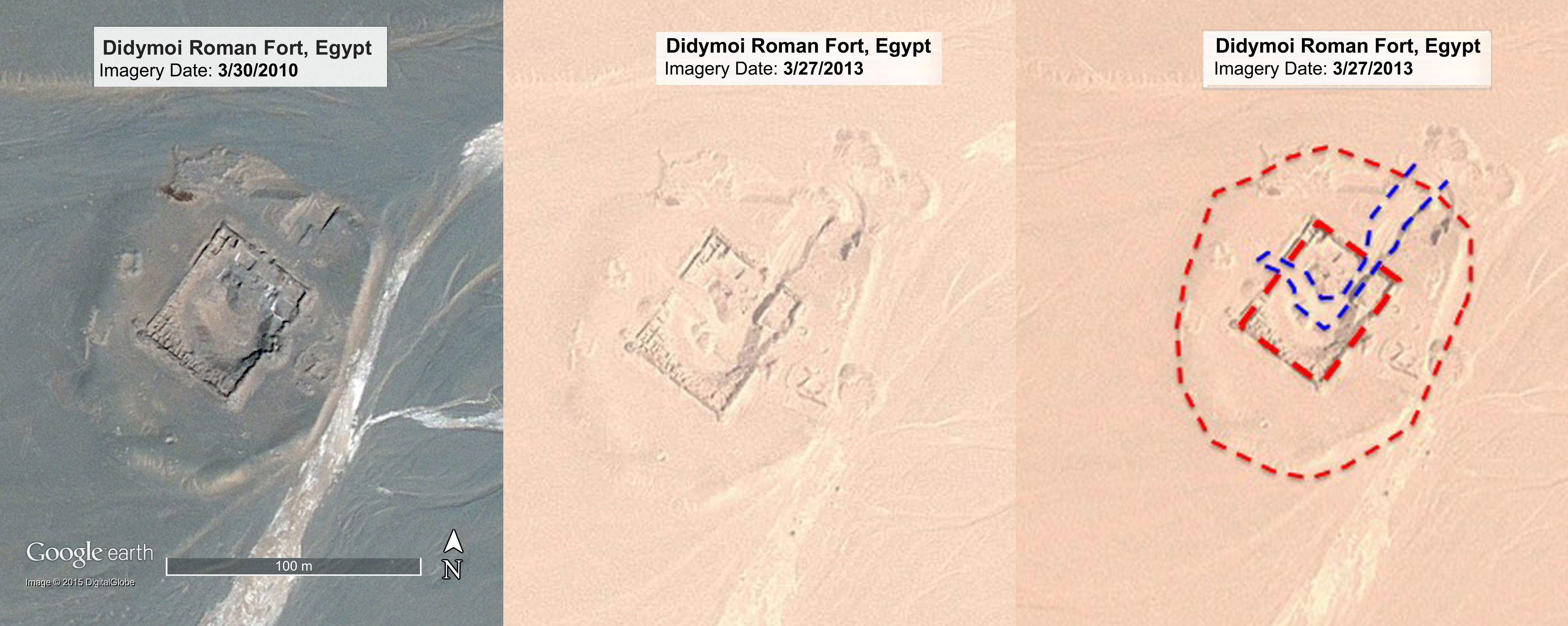
These three images of the 1st century AD Roman Didymoi Fort in the Eastern Desert of Egypt illustrate the power of analysing satellite images and comparing images over time. On the left an image of the fort captured in 2010; in the middle the same view captured three years later in 2013. In the right-hand image the EAMENA team has identified areas of significant destruction to the site, most likely caused by bulldozers. The red dashed line indicates the extent of the site and the damage is outlined in blue.
Interpreting satellite imagery enables archaeologists to search for ancient sites across large areas and in places where it is not safe to work on the ground or where access is severely restricted (e.g. Syria, Iraq, Libya and Yemen). Furthermore, aerial images reveal the 'big picture' of how sites interrelate and form complex social landscapes which transgress modern day boundaries and borders. From the macro to micro, with the development of high definition and high resolution imaging technologies, it is possible for trained specialists to distinguish ancient pits from modern looting holes; man-made spoil heaps from natural and geological forms.
Aerial Archaeology
Combining historic and contemporary aerial photography with satellite imagery provides an important complementary perspective to satellite remote sensing, revealing archaeological features, settlement patterns and relationships between sites that may be difficult to recognise at ground level.
EAMENA draws on the extensive photographic collections and expertise of aerial archaeology projects associated with the University of Oxford, including Aerial Archaeology in Jordan (AAJ) and the Aerial Photographic Archive for Archaeology in the Middle East (APAAME).
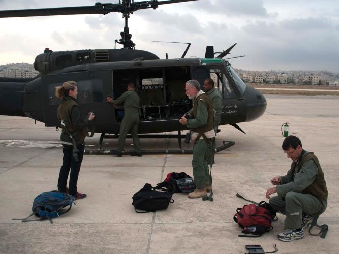
AAJ has conducted aerial reconnaissance in Jordan in collaboration with the Royal Jordanian Air Force, producing valuable photographic records of archaeological sites and landscapes. These images, together with historic aerial photographic collections from across the region, are preserved in the APAAME archive.
Fieldwork
Fieldwork plays an important role in supporting and validating archaeological interpretations made through satellite imagery and aerial photography. Ground-based investigations allow researchers to examine sites in greater detail, confirm archaeological features and gather additional information about their condition, chronology and significance.
EAMENA team members have undertaken fieldwork in countries including Morocco, Jordan, Lebanon, Libya, Egypt and Oman, working alongside regional partners and heritage professionals.
These investigations help refine remote sensing interpretations and improve the accuracy and reliability of the archaeological records held in the EAMENA database.
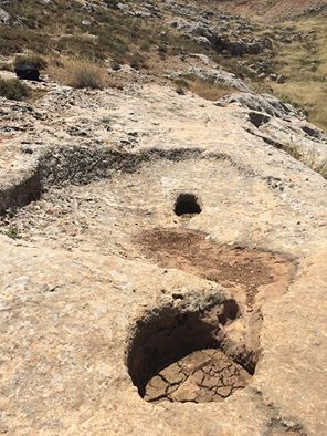
An example of this approach is the identification of an ancient winery in Jordan. Initially recognised through Google Earth satellite imagery by researchers in Oxford, the site was subsequently visited and documented during fieldwork in May 2016. This demonstrates how satellite-based archaeological prospection and ground investigations can work together to improve our understanding of archaeological landscapes.